About
Under the Planning and Environment Act 1987, green wedge land refers to non-urban areas in metropolitan Melbourne that are located outside the urban growth boundary that was put in place by the Victorian Government in 2002.
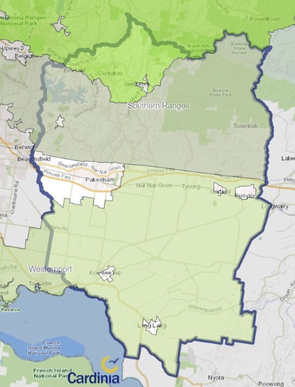
Cardinia Shire contains three green wedge areas:
- Western Port
- Southern Ranges
- Northern Ranges (southern area of Yarra Valley and Yarra and Dandenong Ranges)
In 2019 and 2020-21 the Victorian Government reviewed green wedge and peri-urban areas with the aim of strengthening planning protection of agricultural land that identified as having high-quality soil. Community feedback informed the ‘Planning for Melbourne’s Green Wedges and Agricultural Land Action Plan. View the action plan on the Department of Transport and Planning's Green wedges web page.
Green Wedge Management Plans (GWMP) provide a framework for the sustainable use and development of green wedge land.
Council has prepared a plan for the Cardinia Western Port Green Wedge. Plans for the Northern Ranges and Southern Ranges are yet to be prepared.
Documents
Green Wedge Management Plan
Related documents
-
 Northern Ranges Green Wedge Management Plan - Issues Paper - June 2010PDF (16.97 MB)
 -
Gembrook Rural Review - Action Plan - September 2004PDF (328.87 KB)
-
Gembrook Rural Review - Alternative Agricultural Land Use Options Report - August 2004PDF (549.48 KB)
-
Gembrook Rural Review - Future of the Gembrook Potato Industry Report - March 2004PDF (736.81 KB)


